

Ancient Map of the World
From Darin's Collection
Puzzle enthusiast and collector
5000 Dujardin (107 x 157)
Ancient Map of the World
Artist Unknown
Production Date Unknown
Leyla and I worked on this together and it took about five weeks to complete. It's a difficult to find puzzle and one of my favorites. The cut is very similar to that of Educa.
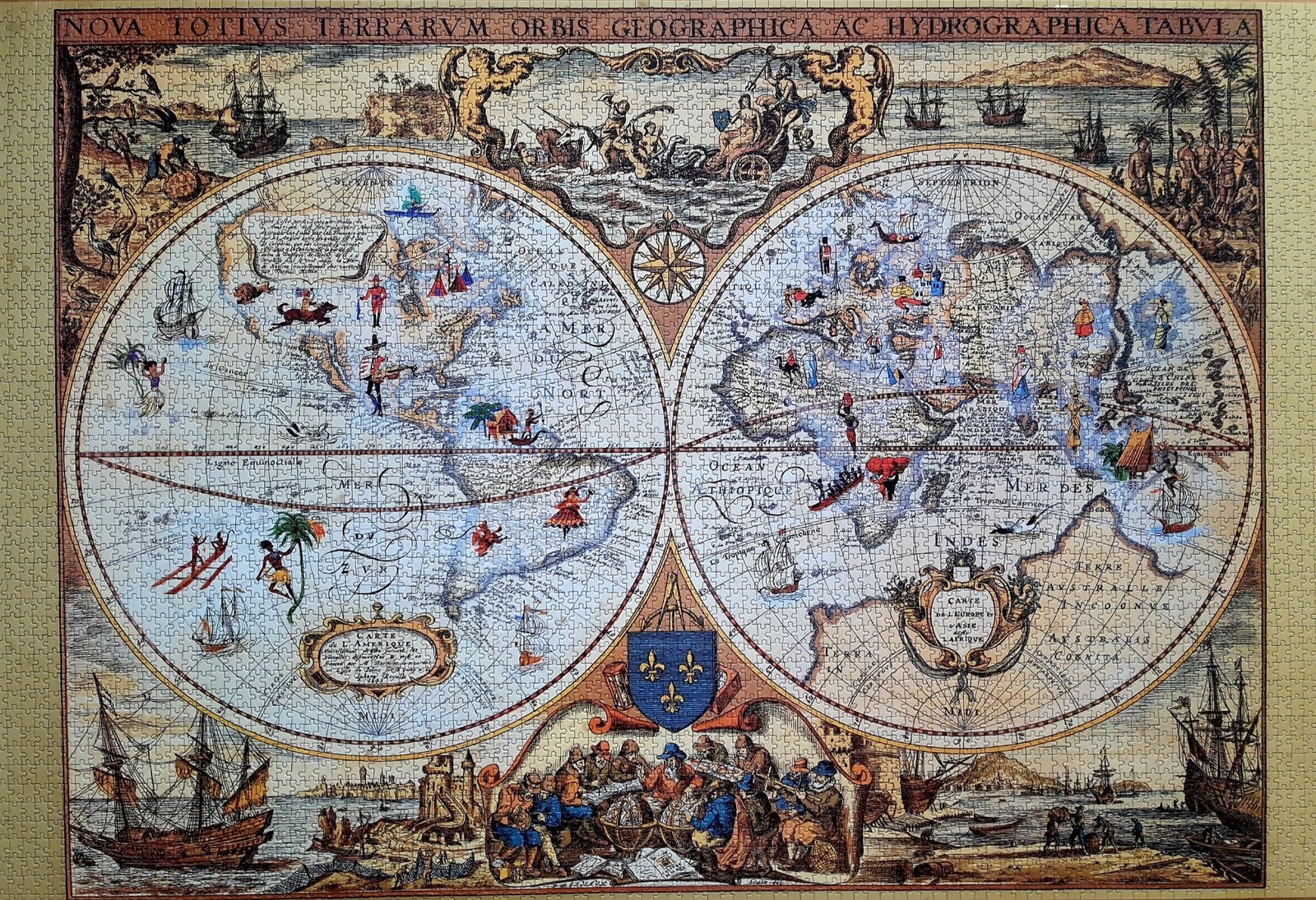
This 17th-century double-hemisphere world map is titled Nova Totius Terrarum Orbis Geographica ac Hydrographica Tabula ("A New Geographical and Hydrographical Map of the Whole Earth"). Originally crafted by Dutch cartographer Henricus Hondius in 1630, this particular decorated variant features French-language cartouches and a coat of arms showcasing three fleur-de-lis flanked by the Order of the Holy Spirit. The map reflects early 17th-century geographical understanding, depicting California as a peninsula attached to North America, showing early partial coastlines of Australia (Terre Australle Inconnue), and populating the interior of continents with colorful illustrations of native inhabitants, fauna, and local scenes. Surrounding the two hemispheres are elaborate decorative borders featuring sailing ships, allegorical scenes along the top, and a gathering of European scholars, navigators, and mapmakers examining globes along the bottom margin.
Ancient Map of the World
Artist Unknown
Production Date Unknown
Leyla and I worked on this together and it took about five weeks to complete. It's a difficult to find puzzle and one of my favorites. The cut is very similar to that of Educa.
This 17th-century double-hemisphere world map is titled Nova Totius Terrarum Orbis Geographica ac Hydrographica Tabula ("A New Geographical and Hydrographical Map of the Whole Earth"). Originally crafted by Dutch cartographer Henricus Hondius in 1630, this particular decorated variant features French-language cartouches and a coat of arms showcasing three fleur-de-lis flanked by the Order of the Holy Spirit. The map reflects early 17th-century geographical understanding, depicting California as a peninsula attached to North America, showing early partial coastlines of Australia (Terre Australle Inconnue), and populating the interior of continents with colorful illustrations of native inhabitants, fauna, and local scenes. Surrounding the two hemispheres are elaborate decorative borders featuring sailing ships, allegorical scenes along the top, and a gathering of European scholars, navigators, and mapmakers examining globes along the bottom margin.